Skip to Main Content
ROC HEALTH DATA
  • Maps & Data
    • Map Room
    • RocHealthData Library
    • Latest Updates to National Maps
  • Regional Data
    • Regional Data Highlights
    • 2018 Community Health Indicators
    • 2017 Community Health Indicators (Archive)
  • Resources
    • Create a Local Health Assessment
    • Other Regional Data Sources
    • Latest Updates to National Reports
  • Support
  • Log In
    • Register

Library

Check out the newest map layers at RocHealthData
9 Dec 2022

Check out the newest map layers at RocHealthData

by RocHealthData Team | posted in: Publicly available data | 0

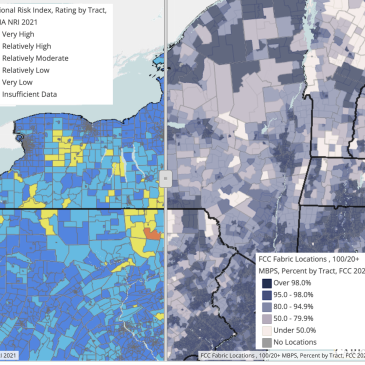
Map layers and report data are updated regularly at RocHealthData. Recently available layers include heat index data, the 2021 FEMA National Risk Index, internet usage at broadband speeds. and drought monitoring data (which is updated weekly).
American Community Survey (ACS), broadband usage, drought, FEMA risk, heat index

Recent Posts

  • January is National Poverty in America Awareness Month: Exploring childhood poverty data for Monroe County
  • Check out the newest map layers at RocHealthData
  • November: Diabetes, COPD, Aviation, Sweet Potatoes, and Charity
  • Tree Coverage and Equity in the City of Rochester
  • October is National Substance Use Prevention Month

Powered by:

Support provided by:

University of Rochester Logo

Community partners:


© 2023 ROC HEALTH DATA Powered by CARES