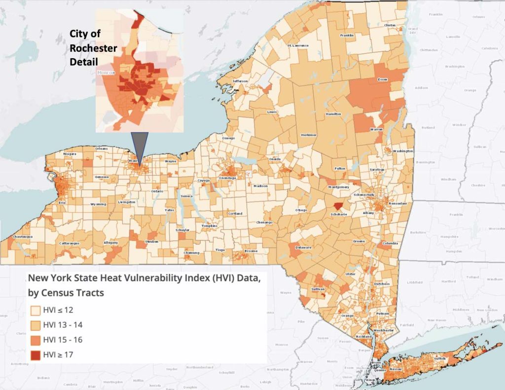
The New York State Department of Health (NYSDOH) has recently released census-tract level data for heat vulnerability. Defined as the ‘likelihood of injury or harm during periods of hot weather’, heat vulnerability has been associated with environmental and sociodemographic characteristics including housing density, proximity to open spaces, race, income, and language spoken. Thirteen (13) individual variables comprise the Heat Vulnerabiltiy Index. More information on the methodology and specific data included can be found here, and in their article published in 2018 here.
Additional data from the NYSDOH includes the components of the Heat Index and may be displayed and overlaid on the Heat Vulnerability map in the RocHealthData map room.
Leave a Reply
You must be logged in to post a comment.